The Aim of the Project
- The project aim is to produce policy-relevant and scientifically based information on wind energy fields, the most affected key natural species populations and social reactions of and economic benefits for the entire Gulf of Riga region.
Objectives
To provide decision makers and potential wind park developers in the Gulf of Riga with
- Reliable marine wind information from coastal wind measurements, high resolution remote sensing data, operational atmosphere model and ensemble of Regional Climate models.
- Accurate high resolution information about ice conditions for different winter scenarios from satellite imagery.
- Information on habitat area for seals and wintering, migrating and breeding birds.
- Mapping the attitude of local people and considering the requirements of the areas for renewable energy.
Expected Results and Outputs
- A decision-making tool based on the spatial planning methods of the Geographical Information System (GIS) environment will be developed to facilitate common planning for the exploitation of wind energy in the Gulf of Riga region.
- Dynamic maps of wind energy, ice conditions, migrating and wintering bird populations, and seals dating back to 2001 and having the projection to future climate will be produced.
- The indicators for spatial planning with regard to public attitude towards the development of wind parks and for the quantification of local plans concerning renewal energy consumption will be developed and integrated into the decision-making tool.
- The outputs of the project contribute to the elaboration of policy-relevant, environmental and socio-economic issues related to the exploitation of renewable energy.
Main Activities
Work Package 2 - Wind and Ice Conditions
Marine wind and sea ice are two main physical parameters that are most important for wind farming.
The objective of WP2 is to provide wind maps and ice charts of the Gulf of Riga area considering the aspects of wind farming.
The activities:
- The collection of existing data and selection of appropriate parameters for wind farming.
- The implementation and improvement of data processing algorithms, and the validation.
- The production of composite wind and ice maps.
The spatial distribution of wind and ice characteristics, wind anomaly areas and areas with extreme ice conditions will be retrieved from a combined analysis of in situ measurements, satellite imagery and model data.
The retrieved high-resolution wind maps will enable the decision-makers to define regions with optimal wind conditions for wind farming. The areas with rough ice conditions (e.g. ridged ice) indicate the regions where building and exploitation of wind farms would be costly compared to the areas with mild ice conditions.
Work Package 3 - Birds and Seals
Birds and seals are considered to be most vulnerable to the installation of wind parks. The Gulf of Riga was classified among the four most important bird areas of the Baltic Sea with up to 1, 5 million wintering water birds and is a very important habitat for ringed seals. Offshore wind parks may seriously conflict with important areas for breeding seals, as well as staging areas and migratory routes of water birds.
The objectives:
- To generate density estimates and spatial model of bird distributions in the Gulf of Riga.
- To map the distribution of ringed seals, their breeding areas and the habitat use.
The activities:
- Transect aerial survey of wintering and migration staging water birds and for the mapping of breeding areas of ringed seals.
- Breeding bird survey on about 50 islands.
- Ringed seals' habitat use will be studied by a telemetry survey.
Fine scale spatial distribution of seabirds in all seasons (winter, spring, summer and autumn), island breeding birds and their feeding grounds and three dimensional habitat use by ringed seals will be produced.
Work Package 4 - Spatial Planning
The selection of wind farm sites has been based purely on wind and available land without community development interest, social aspects or nature protection being taken into consideration.
The WP4 incorporates the results on physical and environmental factors that are coupled with socio-economic layers according to relevant legislative basis to create a cross-border cohesive thematic plan of wind energy development of the Gulf of Riga region.
| |
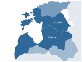
Project Area
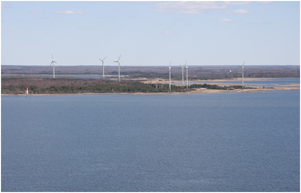
Wind park on the Estonian west coast
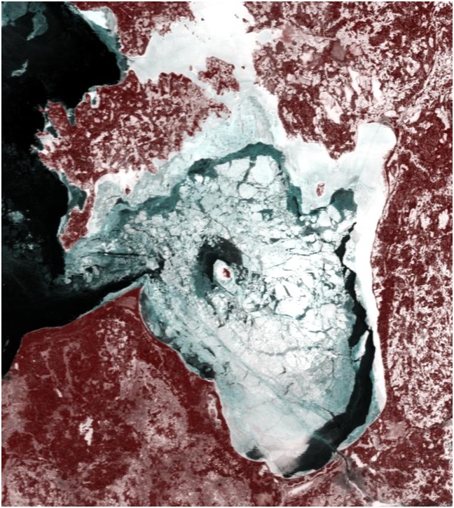
Satellite image of ice conditions
Seal with telemetry device attached

|